
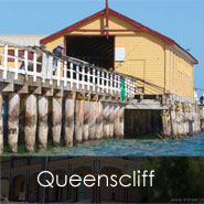
Can you imagine Queenscliff in the future?
We’re interested in your vision of a sustainable future for Queenscliff. So we’re talking to the community to help develop a coastal adaptation plan.
Coastal communities like Queenscliff are at the forefront of climate change in Australia. No-one knows exactly what this might mean but there are strong indications that future changes could include:
- Extreme weather events
- Rising sea levels
- Hotter, drier summers
- Warmer, wetter winters.
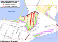
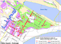
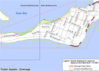
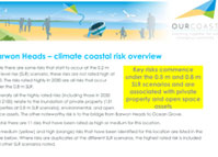
The Our Coast Project has completed the Geelong-Queenscliff Coastal Mapping Project, identifying areas that may experience sea level rise. The research involved a technical assessment by consultants from Cardno, looking at issues including catchment inundation, storm surge and erosion. The assessment includes maps of Queenscliff township and the Laker's Cutting precinct showing the potential impact of sea level rise and severe weather events.
Get involved
An open house event was held in Queenscliff in July 2017 where the community had the opportunity to meet with the experts and gain an understanding of the issue.
Follow up workshops where everyone can provide suggestions for priority actions to be considered in the preparation of our local coastal management adaptation plan will be organised by the Borough of Queenscliffe.
LCHA Coastal Inundation and Asset Location
Climate Coastal Risk Overview
Other Useful Information
Fisherman’s Flat visualisation
More information on the Resource page